- Home
Go to the homepage!
This link takes you back to the Soaring Tigers homepage. - Overview
Overview of our club and info for potential new members
- Quick Facts
Answers to commonly asked questions
- Photos
Soaring pictures taken by Soaring Tigers
A gallery of pictures taken by Soaring Tigers at Van Sant Airport in Erwina PA. - Videos
Soaring videos taken by Soaring Tigers
These videos give a real-time sense of what it is like to soar in a glider. - Member Info
Important information for club members
- FAA
Federal Aviation Administration
See more in MEMBER INFO Online References for Pilots - SSA
Soaring Society of America
See more in MEMBER INFO Online References for Pilots - Van Sant Airport
Our club operates at
Van Sant Airport -
Contact
Soaring Tigers
Mailing addresses:
P.O. Box 1422
Princeton, NJ 08540
Soaring Location:
Van Sant Airport
516 Cafferty Rd
Erwinna, PA 18920
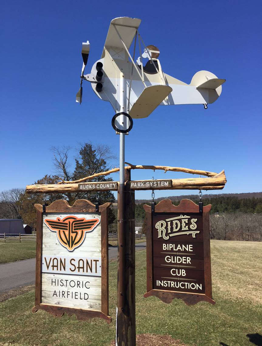
At the entrance to the airport 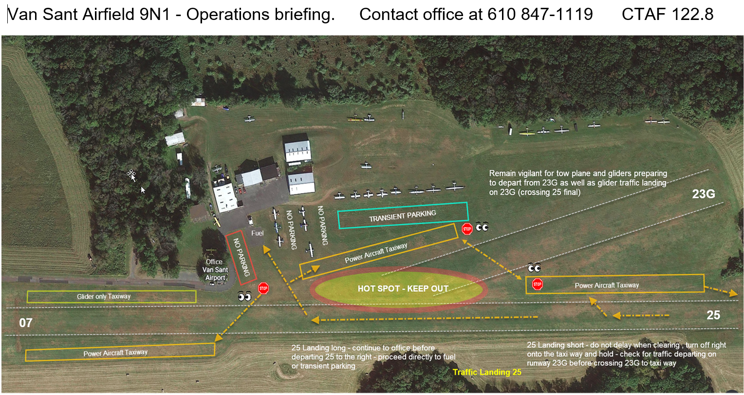
Van Sant Airport Operation map - click to display it full screen 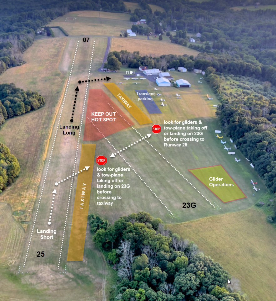
Van Sant Airport Runway 25 map - click to display it full screen 
Bird of Paradise's owners Dannie and Bar Eisenhauer 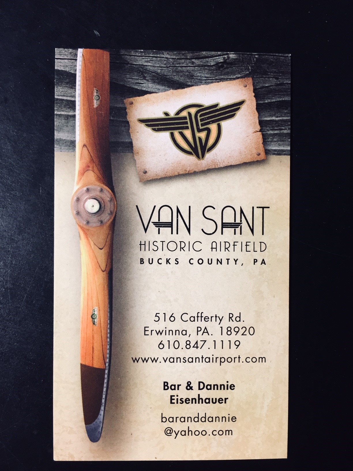
Airport card |
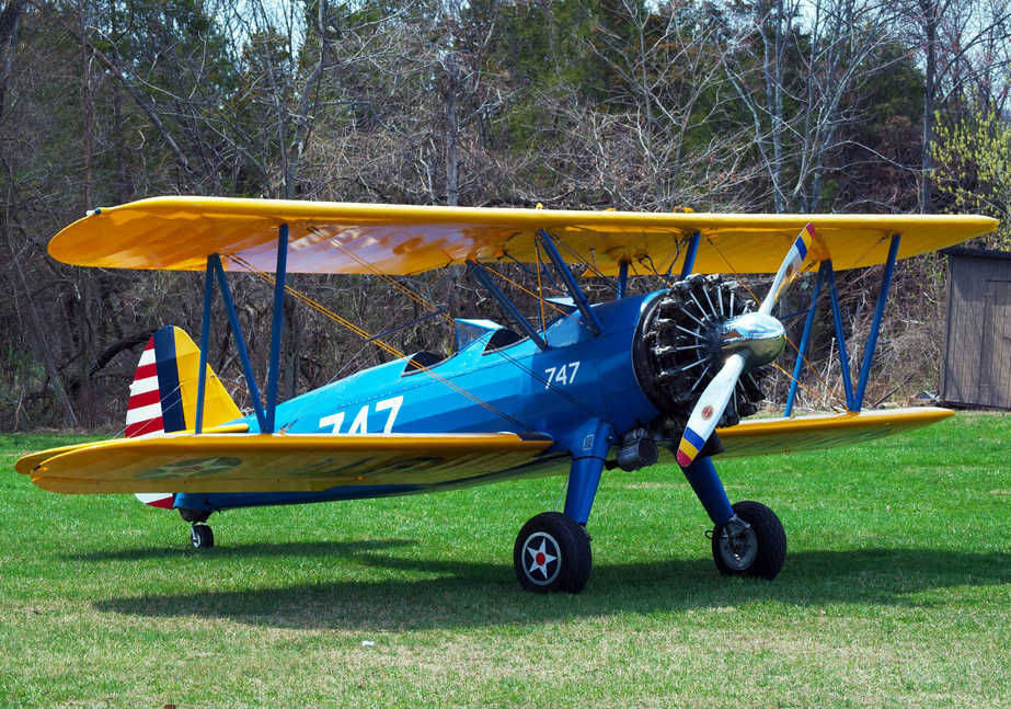
Stearman Biplane 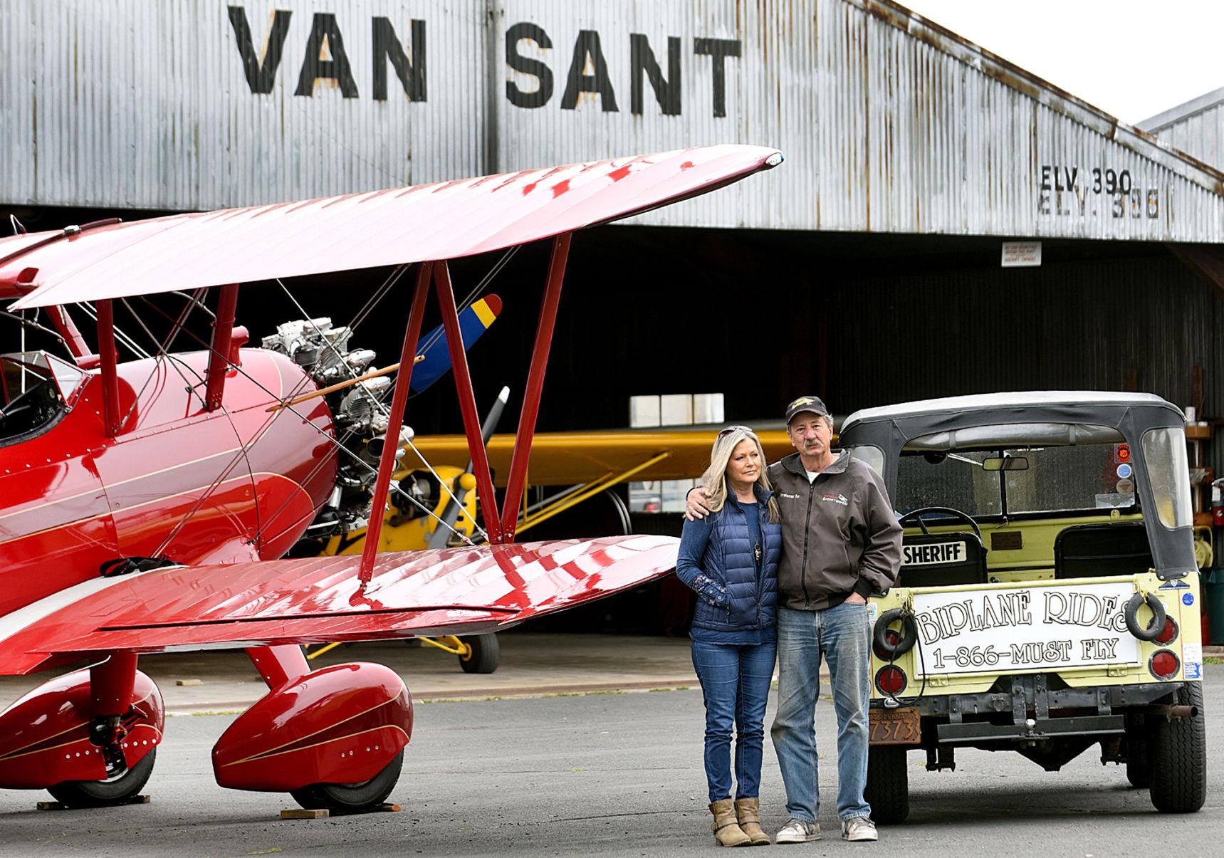
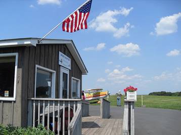
Airport Hanger 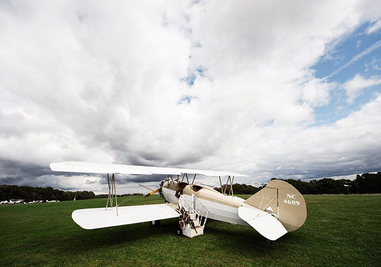
Travel Air |
Van Sant Airport's webpage
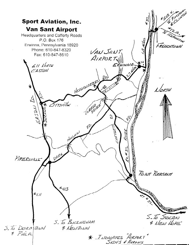
Directions to Van Sant Airport (9N1)
Bird of Paradise phone: (610) 847-1119 and (251) 609-2043
Van Sant Airport 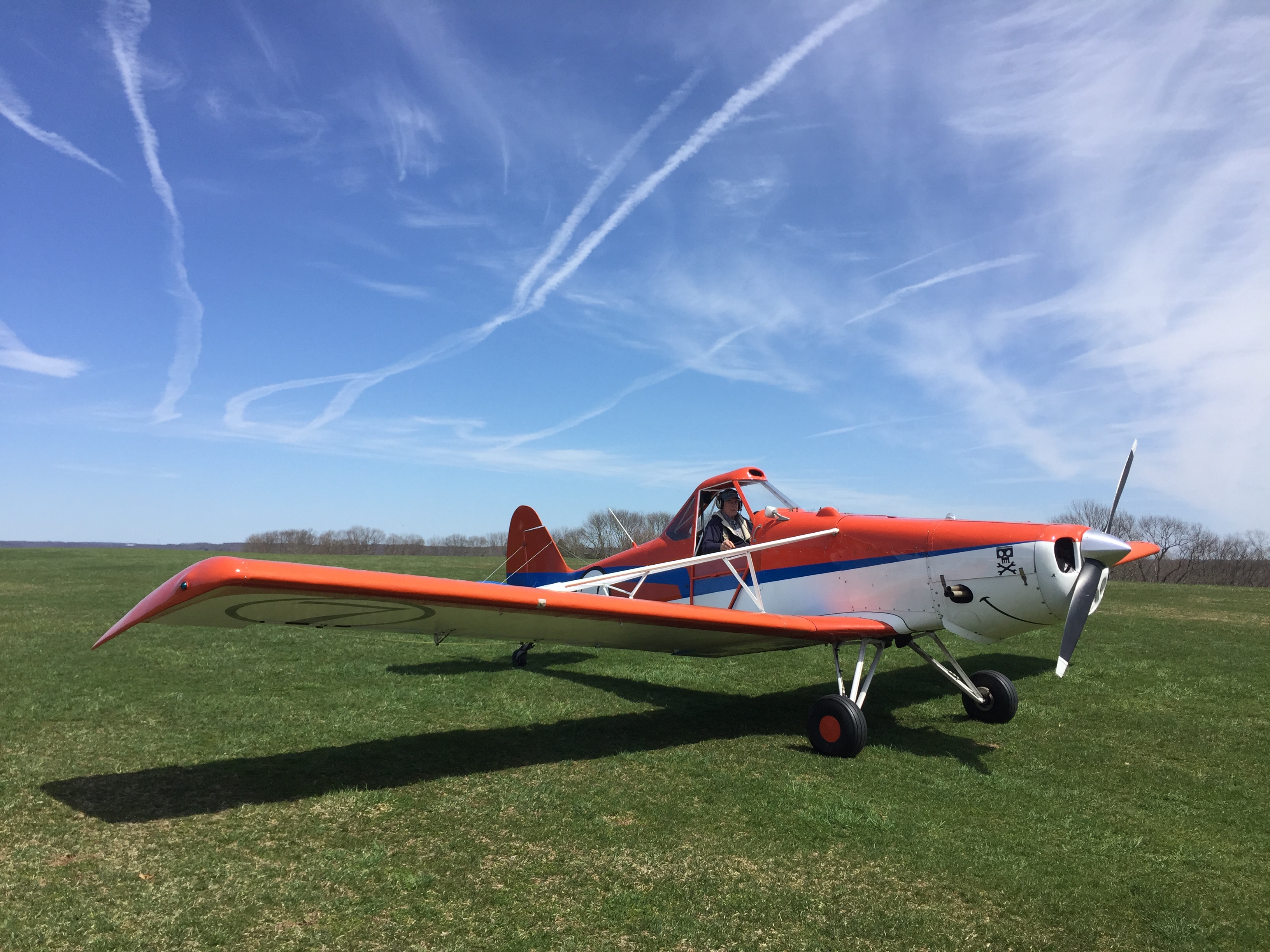
Glider Tow Plane 
Airport Hanger |
From Princeton
Driving time: ~60 min.
- Take 569N (or 206N, 518W) to Hopewell.
- Take 518W through Hopewell, taking the right fork to stay on 518.
- Turn right at the first stop light onto 31N.
- After 31 passes under 202 and enters Ringoes, take the left fork onto 579N.
- Continue on 579 for about 10 miles (including about 100 yards on 523 before turning up the hill).
- At the first stop light, turn left onto 12W and follow it into Frenchtown.
- Turn left onto the main street of Frenchtown and follow it around to the /li.
- At the far end of the bridge, turn left onto River Road, Rte. 32.
- Drive 1.8 miles along River Road and turn right at the airport sign.
- Drive .2 miles and turn left at the Post Office.
- After 2.7 miles on Headquarters Road, turn left onto Cafferty Road.
- The airport is at the top of the hill.
From New York and Northern New Jersey
Driving time: 60-80 min.
- Take 287N to 22W to Somerville.
- Take 202W to Flemington.
- At the circle, take 12W.
- After two more circles and about 10 miles you will reach Frenchtown.
- Turn left onto the main street of Frenchtown and follow it around to the bridge.
- At the far end of the bridge, turn left onto River Road, Rte. 32.
- Drive 1.8 miles along River Rd, and turn right at the airport sign.
- Drive .2 miles and turn left at the Post Office.
- After 2.7 miles on Headquarters Road, turn left onto Cafferty Road.
- The airport is at the top of the hill.
Google map of Van Sant Airport with directions from your starting place
Click here to display the Google map.Airport map